
Studio Sponsorship
Oct 2, 2026
Please fill out our Cal Poly Planning Studio Inquiry form if you are in a community that would like to help support our studios and provide a project for our students to work on.
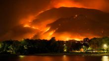
Learning From Floods to Fight Fire: Researchers Release a Guide for Cities to Mitigate Wildfire Damage
Feb 9, 2026
WRITTEN BY ANNMARIE CORNEJO
An interdisciplinary team of researchers from Cal Poly's Wildland-Urban Interface (WUI) Fire Institute recently lauched a new guidebook to improve wildfire mitigation work in urban areas. It provides step-by step guidance to construct a policy driven scorecard focused on strengthening mitigation plans and actions.
The two-year effort to develop the tool, called the Plan Integration for Resilience Scorecard™ (PIRS™) for Wildfire, was done in partnership with Texas A&M and is now available to all community planners, emergency managers and other administrators at no cost.
The guide will help local government and community groups to strengthen risk reduction strategies. “This is a tool that local governments can use to do better, more integrated mitigation planning,” said William Siembieda, professor emeritus of city and regional planning at Cal Poly. “Over the years, especially in California, suppression was the common approach and that is no longer the best path forward. This guide provides the tools needed for improvement.”
The frequency and severity of destructive wildfires in California is increasing, as is the risk to life and property of people living in wildfire-prone areas. As more frequent and severe wildfire and urban fire events are increasing losses of life, property, habitat and ecosystems in California, the United States and across the world, the Cal Poly WUI Fire Institute in the College of Agriculture, Food and Environmental Sciences is working on solutions through innovative research, training and education to create safer and more fire resilient communities in California and the West.
Cal Poly researchers and students from multiple colleges and disciplines partnered with Texas A&M’s Hazard Reduction and Recovery Center to tailor a technique used in the eastern U.S. for flood mitigation for wildfire mitigation. The unique approach integrates with municipal spatial mapping tools that provide key data points that can help city leaders better understand the risks. The research was funded by a grant awarded to the WUI Fire Institute by the Gordon and Betty Moore Foundation.
The guidebook is a spatially derived tool for wildfire mitigation built on modern theory,” Siembieda said. “It uses physical analysis to determine which areas need mitigation by determining which areas score high for being protected or which areas score low, allowing city administrators to adjust local practices as needed and where they are needed.
“As a city develops, there are areas that need more need more wildfire protection — and this guide will allow them to look at existing policies to determine if they adequate to protect those areas.”
The Plan Integration for Resilience Scorecard™ for Wildfire provides an organized, vetted database of the community’s wildfire-risk-affecting policies from across the network of local plans, scored according to their likely effects and their geographic focus. Along with associated maps, derived from the scorecard results, this organization and novel perspective allow local staff to visually analyze areas in their community where policy guidance conflicts, and places that may require greater focus on wildfire resilience.
“Our team spent more than two years developing this plan in an effort to make a direct impact where it is most needed,” said Frank Frievalt, director of the WUI Fire Institute. “This novel approach offers a more holistic approach to the efforts that need to be made is assessing hazard vulnerability.”
Visit the WUI Fire Institute website at fire.calpoly.edu for information on how to obtain the guide.
ARCH Alum Sponsors CRP Studio and Downtown Monterey Revision Plan
Feb 21, 2024
by Caroline Roistacher
This past spring, city and regional planning (CRP) students had the opportunity to enroll in a studio course where they formulated ideas for the downtown area of Monterey, CA. 30 students came up with urban design visions and later traveled to Monterey to visit the site. There, the students met with City and Planning Commission members, business owners and city planners. The meeting between stakeholders allowed the CRP students and faculty to gain insight into the community’s concerns, goals and strengths.
Wallace Gordon, an architecture alum, introduced the project to the CRP Department. As a native of Monterey, Gordon chose to fund and help facilitate this project, donating $25,000 to provide students with the resources necessary for this project. Since Gordon grew up in Monterey, he provided extensive knowledge to the students completing the project by helping explain the historical situation and overall idea. Wallace Gordon giving a fun and insightful tour of Monterey to CRP students Students drove up to Monterey in a charter bus and stayed overnight in a hotel. They walked around Monterey and got to know the area, then later met with the City Council to discuss their plan. The trip was made possible due to Gordon’s generous donation. Since students spent the night in Monterey, they had more time to work on the project in person. “They didn’t have to do it in one day,” CRP Department Head Amir Hajrasouliha said. “Students could visit Monterey, but also the surrounding areas, to have a better understanding of the context, and then spend a day visiting downtown and talking to the business owners.” Left: CRP students during their site visit in Monterey Students experience a wide range of benefits from participating in studio courses. They learn to deal with the essential and critical challenges of urban design planning and consider factors such as housing availability, transportation, tourism, safety, rising sea levels, and more. “I think some of the most fruitful experiences I have were how we interacted off-campus in conjunction with how we were educated on-campus,” Gordon said. “Getting off-campus and seeing and working in the real world is essentially the essence of Cal Poly: Learn by Doing.” For now-senior CRP student Leslie Rivera, being part of the Monterey studio project gave her first-hand experience working with a real-world client. She thought the project was valuable because it helped her learn how a project starts, how to develop a project, and how to work with people who have stakes in the project, both financially and within the needs of their community. Another value is that students get the chance to work with real stakeholders. They met with business owners, planning commissioners and staff for the city to see this project come to life. “Working with a real client and with people having stakes in this project was good experience to learn how to start and develop a project,” Rivera said. This type of work from Cal Poly students benefits them and the communities involved. "The community appreciated working with an emerging generation of planners to discover their perspectives on urban spaces. The City Planning Commission is interested in having students return and discuss implementation options," said Kimberly Cole, community development director at the City of Monterey. Although the course occurred in the spring, the project continued into the summer. With the funds received from Gordon, three students could continue working on the project to revise and edit the plan. Rivera was among the three students who continued working on the project. CRP students' plan for part of downtown Monterey “It’s been a unique opportunity and a really good experience being able to have this project fully funded,” Rivera said. Gordon believes community-based studio projects are an incredible asset to students and communities and would benefit from ongoing sponsorship or donations. “I think the investment in it, from whoever wishes to invest, is a spectacular dividends, both to the school and the community. I would highly, highly encourage people to sustain this and get it to grow,” he said. Gordon believes it is important to give back and help students start their journeys and learn about being a part of the built environment and all the different aspects it takes to come together. “It’s truly a great benefit and joy for somebody who spent their life in design and improving the environment. For me, it’s part of continuing the joy of being an architect,” he said. To support students and help them participate in enriching community-based studios such as this one, please consider donating by clicking Give Now.Click here to read the full report


Right: City staff inform CRP students about downtown Monterey's challenges and opportunities


CRP Professor Vicente del Rio Has Published a New Book
Jan 23, 2024
Professor Vicente del Rio's new book (his tenth!), City Fragments - Reflections on Urbanism and Urban Design, was published in 2023. Organized in two parts (Thoughts and Actions), it includes 15 solo and co-authored essays selected from his 40-plus years career. Published by KDP/Rio Books, the book is available on Amazon.In Rio de Janeiro, the book signing event was at the Brazilian Institute of Architects on December 19, and included a round table with Vicente, Luis Carlos Toledo (former associate and award-winning planner), Edson Mahfuz (professor of architecture and urbanism, author of the foreword), and chapter co-authors Denise Alcantara, Cristiane Duarte, and Nara Iwata. More than 50 friends, local faculty, and professionals came to the event and enjoyed a glass of a good Portuguese red (appropriately called "Urbanista"!).

CRP Students Work to Shape California Communities
Jul 12, 2023
Over the past several months, the graduate Community and Regional Planning Studio (CRP 552/554) and the undergraduate Community Planning Lab (CRP 410/411) have immersed themselves in the communities of Desert Hot Springs and King City.
Under the direction of faculty member Dr. Dave Amos, 15 second-year graduate students worked closely with the City of Desert Hot Springs to create a rehabilitation plan for the downtown core. Their plans have emphasized economic development and improving the pedestrian landscape.
Click here to read the full article.

CRP Faculty Member and YouTube Influencer Dave Amos Brings Urban Planning to the People
Jul 10, 2023
The planner and professor explains how social media can be an informal classroom, how San Luis Obispo uses Instagram effectively, and how his video about Gary, Indiana, went viral.
Click here to read the full article on the American Planning Association website.

Student Receives U.S. Department of Transportation Student of the Year Award
Feb 22, 2023
CRP Symposium - The Future of Planning
Feb 13, 2023
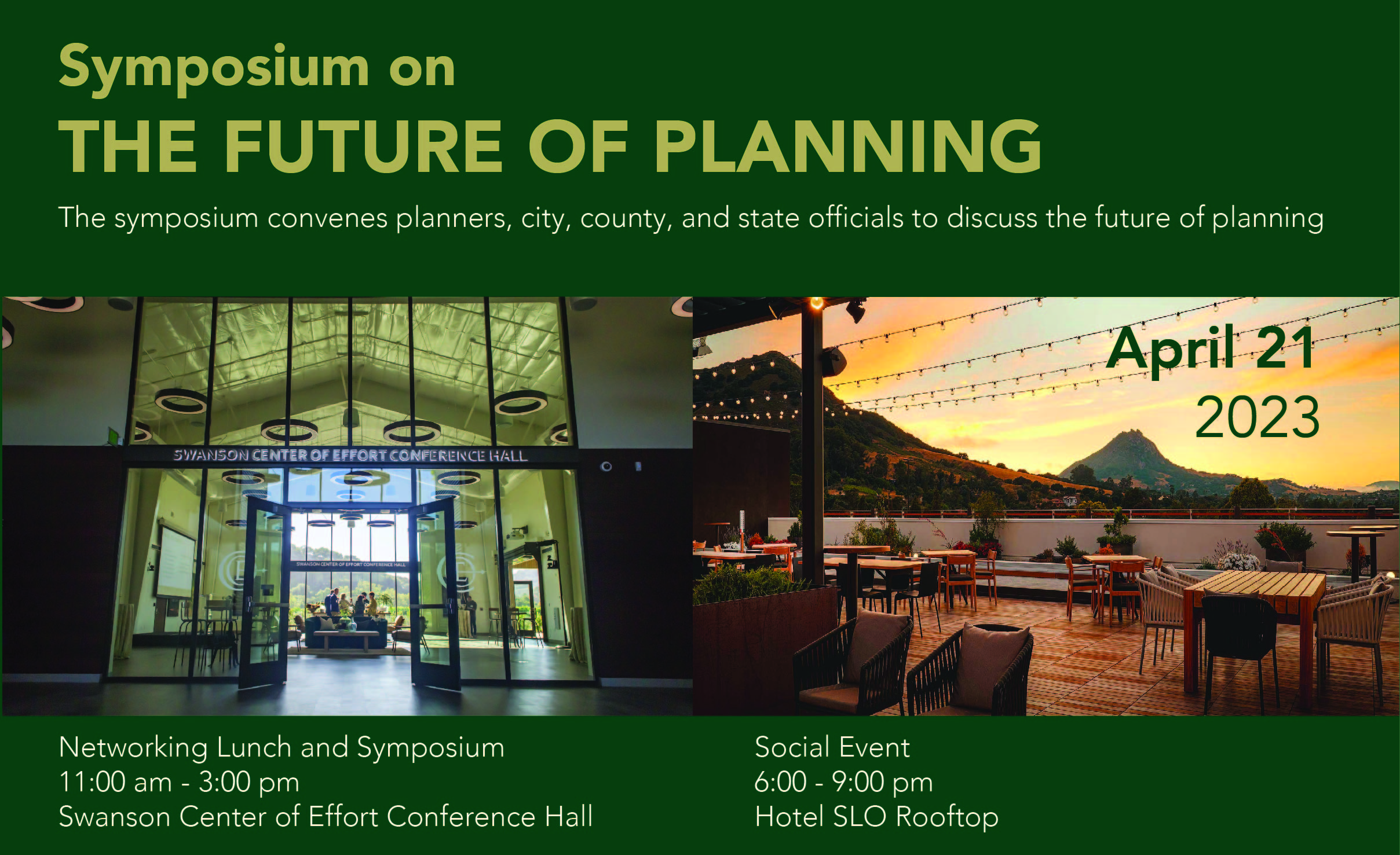
The Cal Poly City and Regional Planning Department hosted a Symposium on “The Future of Planning” as part of the College of Architecture and Environmental Design’s Series of 75th Anniversary Celebrations. The symposium event took place on Friday, April 21, 2023 on the Cal Poly, San Luis Obispo campus.
Symposium attendees heard from speakers on the forefront of planning related to:
- The Future of Planning and Cities
- Ensuring Diversity, Equity, and Inclusion in Planning
- Homes, Health, and Social Justice for Everyone
- Creating Low-Carbon, Resilient Communities
- Advancing the Transportation Revolution
Attendees enjoyed opportunities to discuss and share their ideas on the future of planning with colleagues, friends, faculty, and students during the symposium.


CRP faculty research to design an innovative wildfire mitigation solution
Jan 30, 2023
City and Regional Planning faculty are involved in creating new planning tool for address the wildfire hazard. This is what they are doing.
The problem at hand. Between 2003 and 2021, the top 10 costliest wildland fires in the United States all occurred in California, where one in four people live in an area considered high risk for wildfires. Given the impact of catastrophic fires in western states the need exists for increasing Wildland Urban Interface (WUI) fire resilience through assessing and managing local land use, mitigation and adaptation plans. Most California jurisdictions produce, and utilize many different types of plans (e.g. Safety Element of the General Plan, Hazard Mitigation Plan, and Community Wildfire and Protection Plan) each with its own set of policies, and implementation scheme; generally lacking integration. This is especially true when speaking about hazards, particularly the wildland urban interface fire hazard (WUI) that is usually addressed by several agencies but lacks collaboration and spatial understanding of the heterogenous effects of different policies across a community.
A proposed solution . This research project focuses on applying the Plan Integration Resilience Scorecard (PIRS) method to jurisdictions that are subject to the Wildland Urban Interface (WUI) hazard. PIRS is a methodology that spatially evaluates networks of plans to help reduce vulnerability to hazards. It provides a pathway to adjust multiple policies to improve and strengthen resiliency at the spatial level. Plan integration is the process of harmonizing a jurisdictions network of plans to support community priorities. With support from the Department of Homeland Security(DHS), and a focus on floods, it was first piloted in several East Coast Cities and the Netherlands. Then NOAA provided support for urban heat island hazard using the PIRS method for a pilot in several cities. FEMA has evaluated vulnerability in the Southern usual this method.
WUI however, presents a special challenge in that the hazard itself stems from the dynamics of fuel variables (natural and built) interacting with climate, and human variables. The WUI+PIRS method seeks to strengthen mitigation policy at the local jurisdictional level, improving integration of policies by scoring their influence as mitigation actions and by identifying them spatially.
PIRS+WUI is a three part process. First, hazard zones are defined and mapped creating neighborhood scale units for improved analysis. For PIRS+WUI a combination of CA Fire Hazard Severity maps is combined with census block groups and parcel data. Second, content analysis is used on documents from the jurisdictions “network of plans” to organize a “policy set” related to the hazard that is scored relative to impact on vulnerability, and influences on land use. Finally, physical and social vulnerability are determined for each of the districts and compared to the policy scores. The phases to a PIRS include: creating the scorecard, analyzing the scorecard, analyzing scorecard results, and advancing resilience. The scorecard shows which policies contribute most to building WUI resilience for the jurisdiction.
This project will work with four CA jurisdictions (Atascadero, Temecula, Santa Barbara and Sonoma counties) over a two year periods using a multidisciplinary team of faculty associated with the Cal Poly WUI Fire Institute and the Texas A&M Hazard Reduction and Recovery Center. The Gordon and Betty Moore Foundation provides funding support for this effort.
The Cal Poly team, working the WUI Fire Institute includes: William Siembieda, (Principal Investigator). and Cornelius Norworsoo from City and Regional Planning,, Margot McDonald from Architecture, Andrew Fricker from Geography, Chris Dicus from Natural Resources Management and Environmental Sciences, and Dan Turner from the Firesafe Council. Cal Poly students are involved in developing the GIS maps to use in the analysis phase.


